Discover Cornwall
-
Download our Free Guide to the South West Coast Path
Thinking of walking the South West Coast Path? There is so much information on this mammoth coastal hike that sometimes it is difficult to know where to start.
Luckily it is Macs Adventure to the rescue! Simply download our Free 14-page South West Coast Path guide from the link below to read on your phone, tablet or good old printed page.
![Download our Free Guide to the South West Coast Path]()
-
Lights, Camera, Action in Cornwall!
The picturesque landscapes of Cornwall have inspired many a film-maker and TV producer and here we list some of the famous locations used as sets which you can keep an eye out for whilst you are walking!
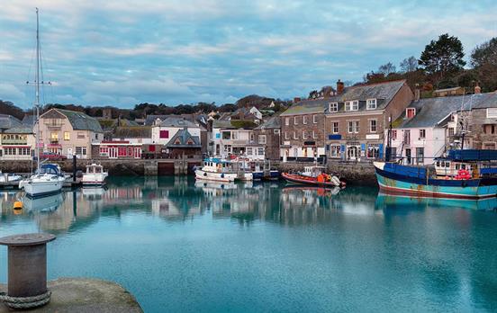
Doc Martin - this popular TV series featuring Martin Clunes was largely filmed in the colourful fishing town of Port Isaac. Fern Cottage in Port Isaac is the fictional Doctor Ellingham's surgery and St Nonna's Church is the setting of Doc Martin's wedding.
Poldark - with its famous large collection of ships, Charlestown was the location for the TV series Poldark, which has captured the hearts of many! Other Cornish locations used in this series are the mines at Botallack, Bodmin Moor, Porthcurno Beach and Kynance Cove.
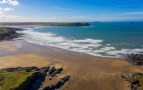
James Bond Die Another Day - the opening beach of this blockbuster which features a "Korean" beach is actually Holywell Bay in Cornwall!
Ladies in Lavender - this romantic comedy featuring Dame Judi Dench and Maggie Smith is set in several locations in Cornwall including Cadgwith Cove, Penzance and Helston.
![Lights, Camera, Action in Cornwall!]()
-
Some Cornish food for thought!
One thing is sure - you will not go hungry whilst walking in Cornwall! Home to some of the finest seafood and with an abundance of fresh local produce, Cornwall is a great place to explore for any food-lovers! Here are some of the regional delights you can expect to find;
The famous Cornish Pasty - great fuel for any walker, this treat is made with short crust pastry and traditionally filled with diced potato, swede, onion, diced or minced beef. Tradition dictates for them to be a proper pasty they must have 20 crimps (the little design on the side).
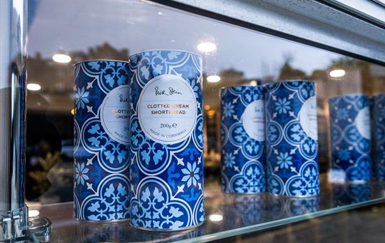
Cornish cream tea - perfect as a treat in the middle of the afternoon (or any time really!) the Cream Tea consists of fruit scones served with clotted cream and jam, accompanied by a fresh pot of tea. Interestingly, in Devon cream tea's are also very popular but there they serve them with the cream on the bottom and jam on the top, whereas in Cornwall it is the other way round!
Saffron Cake - a delicious fruit bun made with the most expensive spice in the world, saffron! Apparently saffron arrived in Cornwall when Phoenician traders arrived to trade it for tin from the mines.
Rick Stein's Padstow - the famous Seafood Restaurant owned by Rick Stein is a Cornwall institution, in operation since 1975. They serve the freshest fish and shellfish and your experience here is sure to be a memorable one - just make sure you book in advance!
Cornish Yarg - for cheese-lovers, you'll be right at home in Cornwall where there are over 60 varieties produced. The Yarg is one of the most famous, which is a hard cheese made from cow's milk and a rind made from nettle.
Stargazy Pie - originating in the tiny village of Mousehole, this unique pie combines eggs, potatoes and pilchards. What makes it so striking is the fact that the pilchards are left sticking out of the pastry on top - or stargazing as such!
![Some Cornish food for thought!]()






PTS/routeimagegallery/SWCPViews-rsz2-25042024160513720.jpg)
PTS/routeimagegallery/MarkNCIandAlethaSWCP-rsz2-25042024160448128.jpg)
PTS/routeimagegallery/PadstowCoves-rsz2-25042024160450814.jpg)
PTS/routeimagegallery/17-LunchatPortreath-CornishPasty-1500x1000-rsz2-18102019112339383.jpg)
PTS/routeimagegallery/PrimaryTourImage-BedruthanSteps.SWCP.PadstowtoStIves-rsz2-31082023150930362.jpg)
PTS/routeimagegallery/SWCPYelloarrow-rsz2-25042024160515274.jpg)
PTS/routeimagegallery/padstowtown1500x1000-rsz2-18102019112354230.jpg)
PTS/routeimagegallery/StIvesLookout-rsz2-25042024160508868.jpg)
PTS/routeimagegallery/StIvesBeers-rsz2-25042024160503780.jpg)
PTS/routeimagegallery/StIvesHeadland-rsz2-25042024160507498.jpg)

STP/routeimagegallery/UmbracoBannerImageUmbraco-DJWC2501-6804-rsz2-22092023155148369.jpg)
STP/routeimagegallery/UmbracoBannerImageUmbraco-UnterkunftSt.IvesPednOlva2-rsz2-22092023155121501.jpg)
STP/routeimagegallery/PrimaryTourImage-SWCP-ZennornachStJust21-rsz2-22092023155417337.jpg)
STP/routeimagegallery/PrimaryTourImage-SWCP-StIves083-rsz2-22092023155532919.jpg)
STP/routeimagegallery/PrimaryTourImage-SWCP-StIvesnachZennor-GurnardsHeadBBZennor85-rsz2-22092023155527607.jpg)
STP/routeimagegallery/UmbracoBannerImageUmbraco-DJWC2396-6787-rsz2-22092023155431836.jpg)
STP/routeimagegallery/UmbracoBannerImageUmbraco-SWCP-StIves022-rsz2-22092023155036361.jpg)
STP/routeimagegallery/21-DinneratPortreathArms-1500x1000-rsz2-18102019164520717.jpg)
STP/routeimagegallery/PrimaryTourImage-GwynverBeachSennen-rsz2-22092023155645892.jpg)
STP/routeimagegallery/UmbracoBannerImageUmbraco-SWCP-PorthcurnonachPenzance-Penberth16-rsz2-22092023155207449.jpg)


 Australia
 New Zealand
 South Africa
 European Union